Temporary exposures, which are opened as a result of new engineering works, provide valuable information on the geology and archaeology buried beneath Cork, as well as former topographic features such as river bars, canals and channels.
The Evidence of Basements
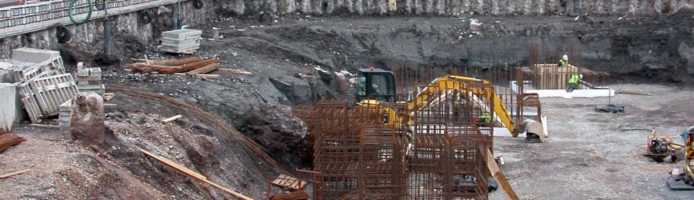
One of the unexpected benefits of constructing underground car parks and shops is that a considerable depth of stratigraphy is revealed in temporary exposures. These basement excavations are extremely valuable within the urban environment, because they offer a rare chance to make in situ observations of the subsurface ground conditions over an extensive area. And there are some surprises.
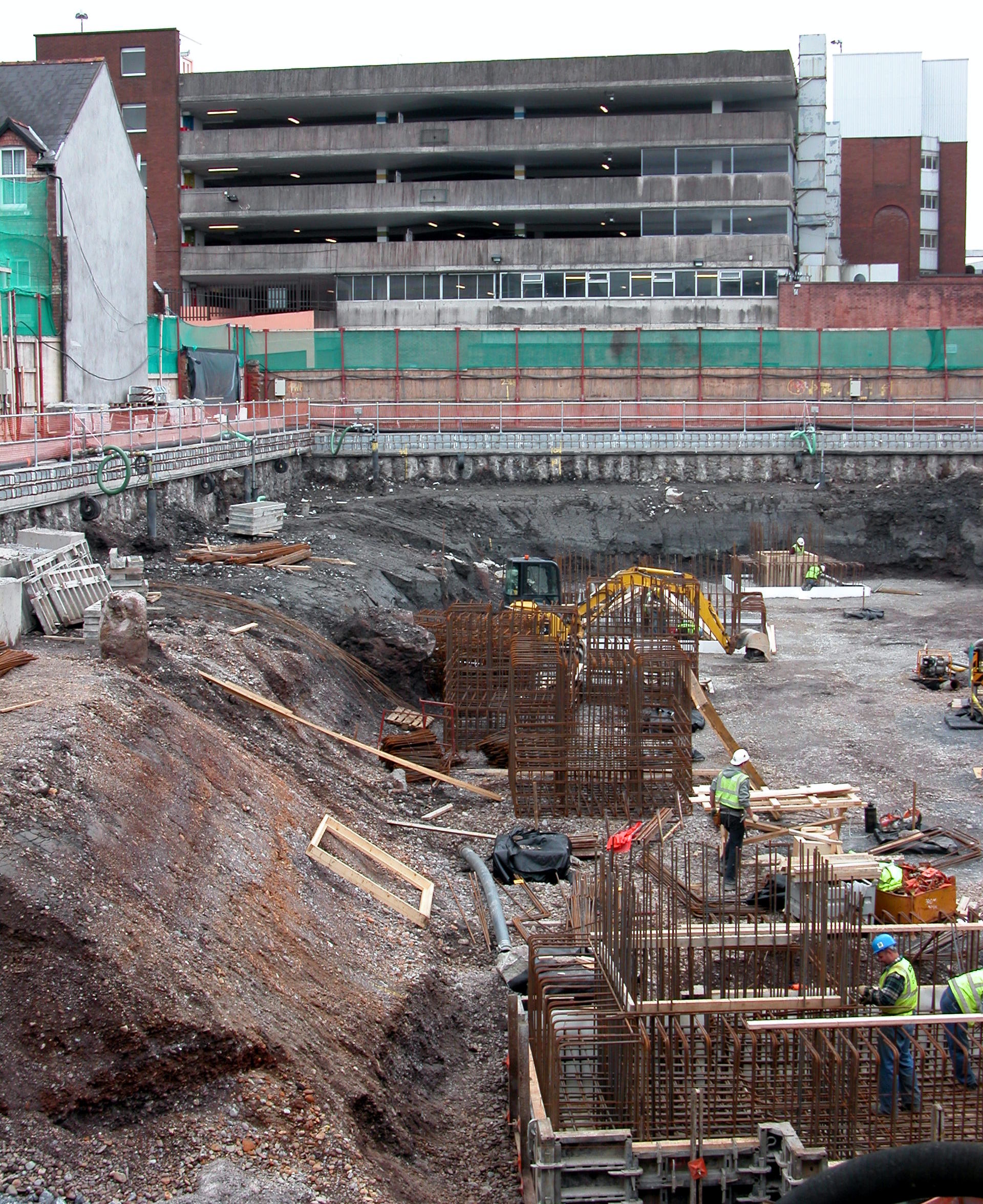

But this new practice of increasing commercial space by excavating deep holes has its downside because dewatering of the saturated sand and gravel deposits is required. This causes major changes in groundwater behaviour, placing the foundations of adjacent buildings at risk and it could be argued increasing the risk of localized flooding as water is displaced. At the same time, the construction of the two-storey basements is expensive. Pumping wells must operate continuously to keep the finished structure dry, and retaining walls formed from contiguous bored piles are necessary in order to prevent ground movements.
The Evidence of Culverts
Except for the main North and South Channels, the former canals and waterways of Cork have now been culverted. In most cases, the channels are now confined to masonry and brick structures that follow the course of streets, although there are a few culverts lie under buildings. A detailed knowledge of the layout of the culverts was obtained during works for the Cork Main Drainage (CMD) Scheme (1999-2005), when integrity surveys were completed throughout the city on behalf of Cork City Council. Some culverts were revealed in temporary excavations opened during the works, which included street renewal. Examples of primary evidence for former watercourses include a double culvert discovered at the north end of South Main Street (the former ‘Middle Channel’) and a shallow culvert under Grand Parade (the former ‘Eastern Canal’).
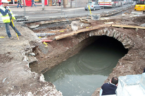
The colour image above shows the slack tidal flow in the limestone and brick culvert at the northern end of Grand Parade. The view is to the south and the entrance to St Patrick’s Street is just visible on the left, behind the man with the fluorescent jacket.

The black and white image (right) shows an outfall at the northern end of Corn Market Street. The outfall is interpreted as being located at the former confluence between a secondary estuarine channel and the North Channel. This lesser channel was later incorporated into the ‘Eastern Canal’ and formed an inlet that was wide enough for boats to enter.
And Trenches
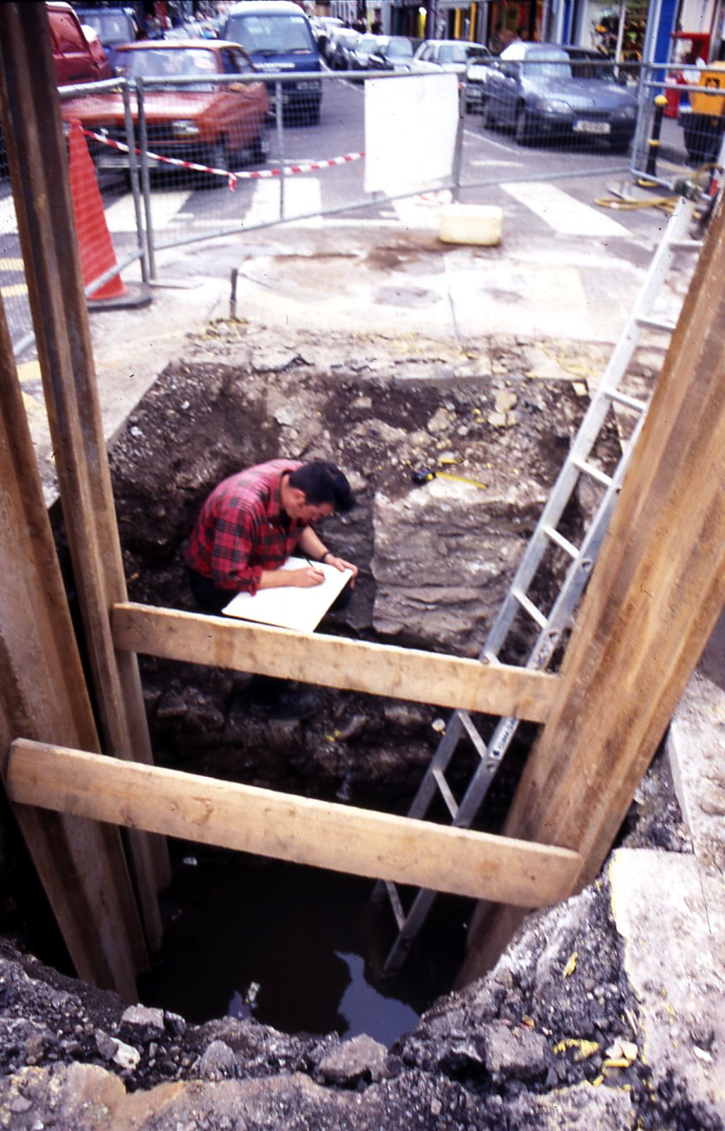
Trench 309, Washington Street
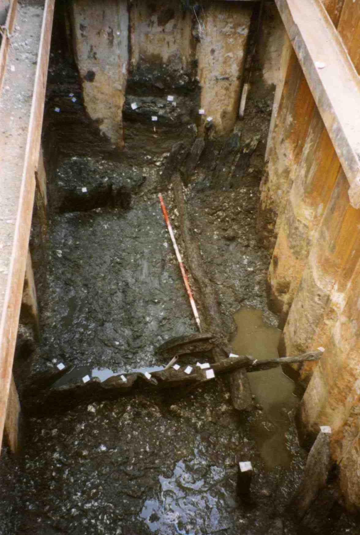
Archaeological investigations in Cork are not straightforward because of the city’s intertidal context. The image was taken from street level and looks into Trench 309, opened during the CMD Scheme. The excavation had to be supported with sheet piling and pumped out continuously. Note the tops of two timber fences, protruding from the organic silt. The fences are interpreted as revetments that acted as a defence against erosion and flooding. Thus, they were an important element of the land-claim. At Washington Street, the revetments comprised oak staves that were driven into the estuarine silt at 4m below street level, which is approximately 1m below mean sea level. The wet mud in the photograph is filling that was brought in by the Hiberno-Norse people in order to raise ground levels. The white fragments in the dark mud are oyster shells that were discarded along with other food waste.
Quay at North Main Street?
The context of many of the archaeological features, revealed during the CMD Scheme, was difficult to determine because most trenches were narrow. For example, the limestone wall, shown in the image to the left, has been interpreted as a possible quay but could also be part of a building such as Roche’s Castle. The interpretation of a quay is based on the fact that an intramural waterway is thought to underlie Castle Street. The purpose of the waterway was to provide a secure mooring place for boats. It was established during the Anglo-Norman period by widening that part of the ‘Middle Channel’ that was just inside the watergate between King’s and Queen’s Castles The existence of an old culvert under the houses on the southern side of Castle Street indicates that the waterway extended further south; and it is probably significant that a double-arched culvert was observed directly to the east during trenching at Paradise Place. The history of the Castle Street waterway is available in Gina Johnson’s excellent book, The laneways of medieval Cork, published by Cork City Council in 2002.